Stay up to date with our newsletter
Defining Maine:
Traveling Through Maine 200 Years Ago
Educational Materials
In the following activities, students will analyze excerpts from Treat’s journal entries to explore what Maine looked like in 1820. Students will be prompted to draw conclusions about how our understanding of the land and its resources has changed over time.
These worksheets actively guide students through a close analysis of the writing and drawings from the 1820 journey. They use Treat’s journal and the Moses Greenleaf map as a primary source.
Taking a Closer Look
Journal Entries
Journal Entry for Wednesday, 27th September – Thursday, 28th September 1820
Journal Entry for Friday, 29 September 1820
Journal Entry for Thursday, 18th October 1820
Journal Entry for Thursday, 25 October 1820
Journal Entry for Tuesday, 31 October 1820
Journal Entry for Sunday 5th November – Wednesday 8th November 1820

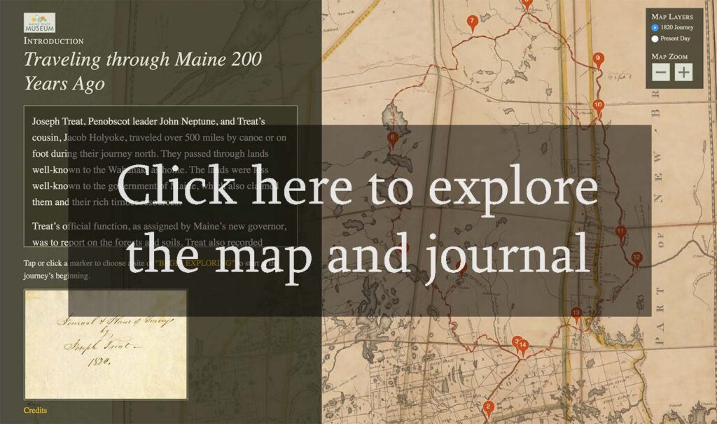
Explore an interactive 1820 map and journal
In 1820, the District of Maine became an independent state. Much of northern and eastern Maine was wilderness, and the boundaries were not clearly defined. Maine’s first Governor, William King, sent Major Joseph Treat to survey the northeast section of Maine. Treat enlisted the help of John Neptune, lieutenant governor of the Penobscot tribe, to guide him across the Wabanaki homeland.
Treat kept a detailed journal chronicling their journey, describing the condition of the land, settlements, Native camps, timber resources, and evidence of illegal logging operations.