Stay up to date with our newsletter

Traveling through Maine 200 Years Ago
Exhibit
Currently online
Maine State Museum (website)
Traveling through Maine 200 Years Ago
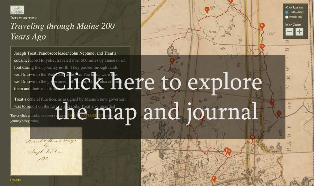
In 1820, the District of Maine became an independent state. Much of northern and eastern Maine was wilderness, and the boundaries were not clearly defined. Maine’s first Governor, William King, sent Major Joseph Treat to survey the northeast section of Maine. Treat enlisted the help of John Neptune, lieutenant governor of the Penobscot tribe, to guide him across the Wabanaki homeland.
Treat kept a detailed journal chronicling their journey, describing the condition of the land, settlements, Native camps, timber resources, and evidence of illegal logging operations.
The interactive Treat map was on display in early 2020 in the short term exhibit on Maine’s Bicentennial titled Regional Struggle-National Story: Maine’s Path to Statehood. Learn more about the former exhibit and access related educational materials here.
Website development was funded in part by:
Maine Humanities Council and the National Endowment for the Humanities as part of the American Rescue Plan Act of 2021
Maine Arts Commission, an independent state agency supported by the National Endowment for the Arts